CSA was contracted to conduct a feasibility study and prepare all environmental permit applications and a U.S. Coast Guard license application for the Port Dolphin deepwater port liquefied natural gas (LNG) facilities. The unloading portion of the deepwater port is located in federal waters approximately 45 km (28 mi) offshore Tampa Bay, Florida in approximately 30 m (100 ft) of water. The gas transmission line connects to a shore facility in Manatee County, Florida.
CSA utilized Geographic Information Systems (GIS) to collect, analyze, and document all biological data in accordance with requirements of the Department of Transportation, U.S. Coast Guard, Bureau of Ocean Energy Management (then Minerals Management Service), Environmental Protection Agency, U.S. Army Corps of Engineers, and State of Florida and in compliance with the National Environmental Policy Act, Deepwater Port Act, Homeland Security Act, and other regulations.
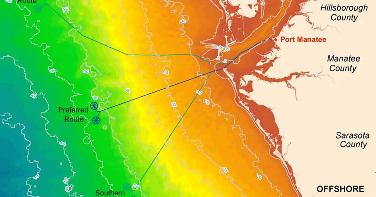
Geospatial technologies, including remote sensing, were utilized to support exclusionary mapping processes at the program planning phase. Large areas of interest were reduced by identifying sites of high and low priority. Using GIS for exclusionary mapping and site selection enabled the focus of alternative analyses and the value of field survey efforts by avoiding sensitive areas, demarcating explicit sampling boundaries based on selected parameters, avoiding potential danger zones, and prioritizing areas. GIS was used to analyze, overlay, and display biological resources with other datasets and produce customized maps. The geospatial database allowed for spatial queries so that management options could be quickly evaluated in terms of relative area impacted by potential activities around selected features. The use of spatial analytics aided in the route design of the proposed gas transmission line.
CSA integrated GIS with field survey efforts to help plan, mobilize, and conduct field activities. GIS was used to coordinate with field teams to estimate transit distances and times between bases of operation and sampling stations, determine the most efficient survey scheme and schedule, and produce maps to guide navigation and sampling activities. CSA utilized GIS in the management of field surveys to check accuracy of planned and actual survey locations, log sample and measurement locations, monitor progress of survey activities, and record any changes to the field plan. GIS was used to georeference the benthic photo and video documentation from the field surveys. Marine habitats were delineated by CSA scientists, and the information was compiled into benthic habitat maps. The maps and associated geodatabase were used in the route selection process. GIS maps and summary tables were utilized throughout CSA's easily understood environmental permitting documentation.