The CSA GeoSpatial Services (GSS) business line provided imagery acquisition and interpretation services for marine habitats (benthic and terrestrial) to support the Naval Facilities Engineering Command (NAVFAC) Atlantic under the Comprehensive Long-Term Environmental Action Navy (CLEAN) 1000 Contract for the proposed installation of a waterway barrier system within Bahia Icacos, located at the former Vieques Naval Training Range (VNTR) on Vieques, Puerto Rico. The satellite mapping data were used to plan and conduct the field investigation and select sites for ground-truthing to produce the benthic habitat characterization. All primary marine species—corals (including endangered and threatened species), seagrasses, fishes, macro-invertebrates, and sea turtles—occurring in the project area were indentified to lowest possible taxon and their locations mapped relative to proposed waterway barrier structures.
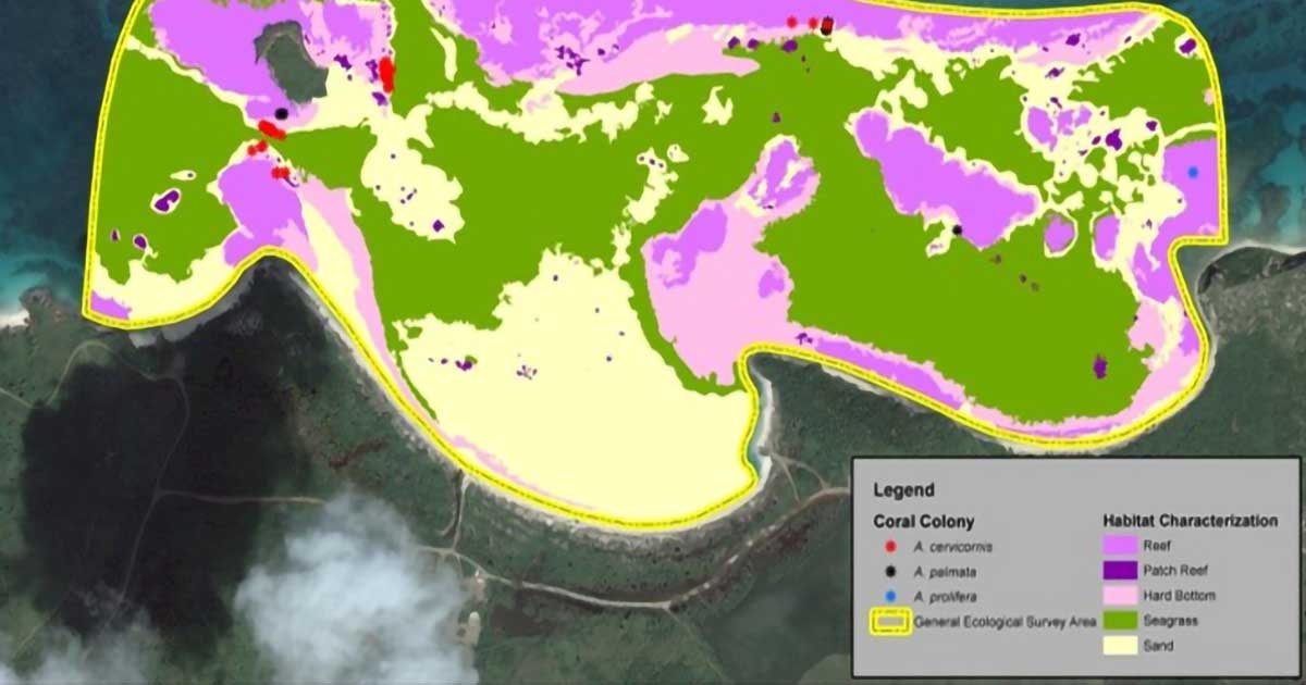
The benthic habitat characterization map was developed to show the locations of coral reefs, seagrass beds, sand bottom, and other identified benthic habitats in the project area. Areas that contained listed and/or candidate coral species were also identified on the map and in the ESRI geodatabase. Areas representing critical habitat for staghorn and elkhorn coral were also delineated and provided as a thematic layer for the benthic habitat characterization map.