CSA Conducts Geophysical and Unmanned Aerial Surveys in Barbuda
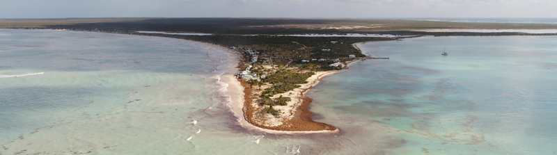
In March 2018, CSA Ocean Sciences Inc. (CSA) was engaged to support assessment efforts along the damaged west coast of the island of Barbuda in the eastern Caribbean. Part of the sovereign Commonwealth nation of Antigua and Barbuda, the island was devastated by Hurricane Irma in 2017.
On an island where logistical support for survey planning is limited, CSA formed a multidisciplinary survey team using personnel and equipment from CSA’s Florida headquarters, CSA’s Trinidad branch office, and CSA’s subsidiary Morgan and Eklund Land & Hydrographic Surveyors (https://morganeklund.com/) to conduct the geophysical and unmanned aerial surveys needed for the assessment. Additional challenges included the island’s wave regime and complex seabed undulations.
Geophysical survey data were acquired to 20 m water depth using a suite of CSA’s hydrographic equipment, including single-beam, sidescan sonar, sub-bottom sonar systems, tide gauges, and global navigation survey systems.
Nearshore bathymetry was mapped along the western isthmus of the Codrington Lagoon and along the southern coast of the island, including Cocoa Point. Digital sidescan sonar systems operating with a dual frequency were used to obtain high-resolution images of seabed features. An EdgeTech CHIRP 3100 sub-bottom profiler was used to examine shallow geologic features for potential beach nourishment efforts along the west side of the island/lagoon isthmus.
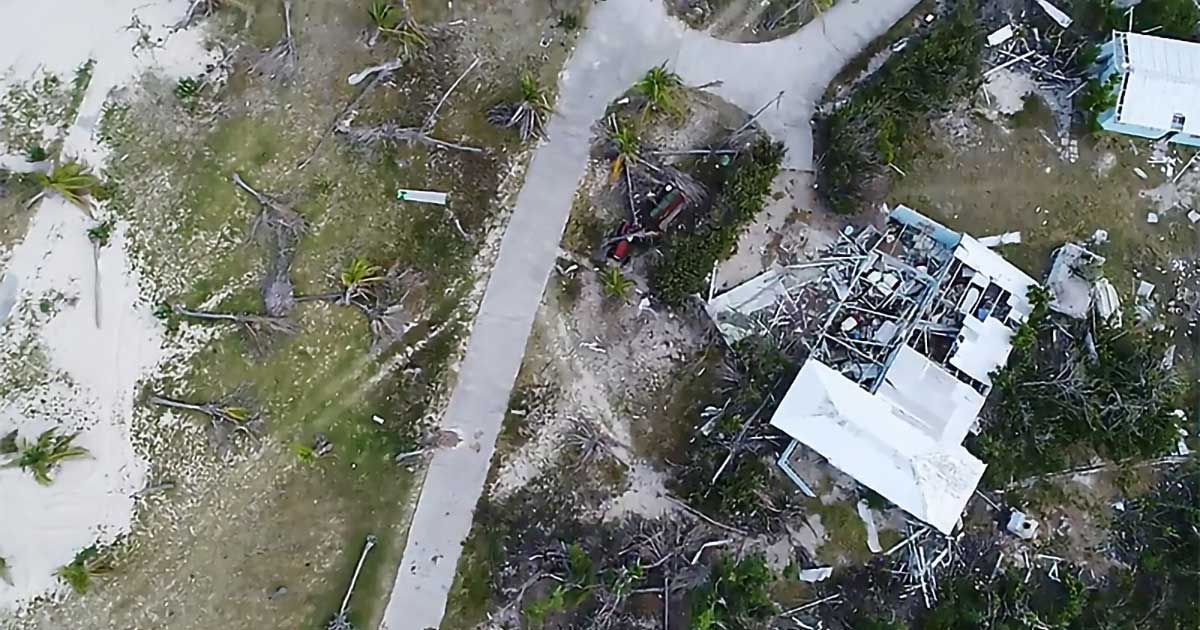
Aerial imagery was collected using Unmanned Aerial Vehicles (UAVs) operated by a certified UAV pilot from CSA. Using Geographic Information System (GIS) technology, the resultant georeferenced imagery can be viewed as video, digital stills, or an integrated mosaic, as well as overlain with terrain maps and nautical charts.
Hydrographic survey data are crucial to inform coastal land development planning. Providing an understanding of seabed undulations and subsurface characteristics supports engineering decisions related to coastal development. Hydrographic survey data can be post-processed to map seafloor features and model nearshore coastal hydrodynamic conditions in anticipation of shoreline stabilization planning, development, and construction efforts.
Aerial imagery is useful to improve the understanding of ground conditions, including the extent and status of sensitive terrestrial and wetland resources such as forested mangrove communities. Use of UAVs and image processing software is particularly useful in areas that are difficult to access for safety or logistical reasons.
Acquisition and integration of land-based imagery and subsurface hydrographic data provided a better understanding of the current coastal conditions in Barbuda.
Corporate Headquarters
8502 SW Kansas Ave.
Stuart, FL 34997